
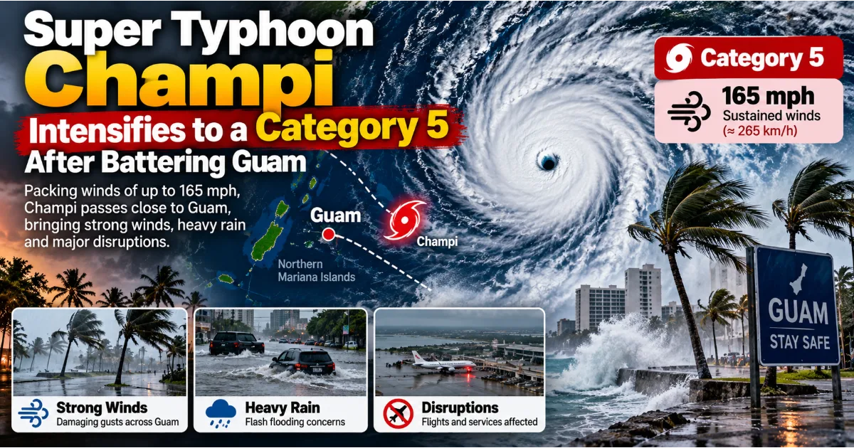
Packing winds of up to 165 mph after passing south of Guam, Champi highlights the growing challenges of forecasting rapidly intensifying storms, protecting vulnerable island communities, and preparing for a more dangerous Pacific typhoon season
The western Pacific has witnessed another extraordinary display of nature's power as Super Typhoon Champi intensified into a Category 5 equivalent storm shortly after passing close to Guam. The cyclone strengthened from a powerful Category 4 system into a storm with estimated sustained winds of approximately 165 miles per hour, or 265 kilometres per hour, placing it among the most intense tropical cyclones observed globally in 2026.
Champi's closest approach to Guam came on Saturday, October 17, when the storm's centre passed roughly 12 miles, or 20 kilometres, south of the island's southern tip. The cyclone's northern eyewall brushed the southern part of Guam, while its compact wind field meant that the strongest winds remained concentrated over a relatively limited area. Although the island avoided the most catastrophic wind impacts that had been feared, damaging winds, heavy rainfall, flooding concerns, hazardous coastal conditions, and disruptions to essential services remained serious threats.
The storm's development became even more remarkable after it moved away from Guam. Meteorological analysis upgraded Champi to Category 5 equivalent intensity around six hours after its closest approach, with the Joint Typhoon Warning Center estimating sustained winds of 165 mph. The system subsequently weakened as its inner structure changed, but forecasters warned that the surrounding ocean and atmospheric conditions could support renewed intensification.
The distinction between a storm's location and its intensity is important. Champi did not need to make a direct landfall over Guam to create dangerous conditions. Its proximity, powerful winds, rain bands, and effects on surrounding waters were enough to trigger emergency preparations and disrupt daily life across the Mariana Islands.
For residents, emergency officials, airport operators, health facilities, businesses, and families, the event was a reminder that tropical cyclones can change rapidly and that a narrow difference in the storm's track can significantly alter the outcome for an island community.
Champi's story is therefore not simply about a storm reaching Category 5 strength. It is also about the science of rapid intensification, the vulnerability of remote islands, the importance of early warnings, and the difficult decisions authorities must make when a powerful cyclone approaches a populated area.
What Is Super Typhoon Champi and How Powerful Did It Become?
Champi is a tropical cyclone that developed over the western Pacific Ocean and strengthened as it moved towards the Mariana Islands. Tropical cyclones form over warm ocean waters when atmospheric conditions allow thunderstorms to organise around a developing low-pressure centre. Under favourable conditions, the system can develop a closed circulation, stronger winds, organised rain bands, and eventually the structure associated with a typhoon.
The term typhoon is used for powerful tropical cyclones in the northwestern Pacific. The same general type of weather system is called a hurricane in the Atlantic and eastern Pacific, and a cyclone in several other regions. The names differ by basin, but the underlying phenomenon is similar: a rotating storm system that draws energy from warm ocean water and releases heat through deep clouds and thunderstorms.
Champi's intensity became particularly notable when the Joint Typhoon Warning Center reanalysed the storm and upgraded its estimated strength to the equivalent of a Category 5 hurricane. The reported peak sustained winds reached approximately 165 mph, or 265 km/h. Winds at this level can cause severe damage to buildings, vegetation, power infrastructure, and other exposed structures when the strongest part of the storm moves over land.
The Category 5 label is based on the Saffir-Simpson Hurricane Wind Scale, which is widely used for Atlantic and eastern Pacific hurricanes. It begins at sustained winds of 157 mph. The western Pacific does not universally use this exact scale as its formal classification system, so describing Champi as a Category 5 equivalent storm is a useful way to communicate its wind intensity to an international audience.
The classification also needs context. A storm's category reflects its estimated maximum sustained wind speed, not every dimension of its danger. It does not directly measure rainfall totals, the height of coastal waves, the likelihood of flash flooding, the width of the wind field, or the storm's overall impact on a community.
A compact Category 5 cyclone can have an extremely violent core but a relatively small area of the strongest winds. A weaker but much larger storm can expose more people and infrastructure to damaging conditions for a longer period. Both systems can be dangerous, but the hazards may differ considerably.
Champi's development demonstrated why meteorologists examine more than one number when assessing a storm. Its peak winds were extraordinary, yet the storm's compact structure helped limit the area exposed to its most intense winds during its closest approach to Guam. That did not make the event harmless. It meant that the location of the core and the distribution of its wind field were especially important in determining the impacts.
How Champi Passed Close to Guam Without Causing the Worst Feared Wind Damage
Guam is a United States territory in the western Pacific and part of the Mariana Islands. Its location makes it vulnerable to tropical cyclones that travel across the Pacific, particularly during periods when warm ocean waters and favourable atmospheric conditions support storm development.
When Champi approached, forecasts indicated that it could pass close to or over Guam at dangerous intensity. Authorities prepared for destructive winds, heavy rain, flooding, and dangerous sea conditions. The storm's track was therefore watched closely because even a relatively small change in its path could have placed more of the island beneath its strongest winds.
The cyclone's centre ultimately passed south of Guam, approximately 12 miles from the island's southern tip. Its northern eyewall came close enough to affect the southern part of the territory, but the strongest typhoon-force winds remained concentrated within a compact section of the system.
This detail helps explain why the outcome was less destructive than some of the most concerning forecasts had suggested. In a powerful tropical cyclone, the eyewall is the ring of intense thunderstorms surrounding the eye. It commonly contains some of the storm's strongest winds and heaviest rainfall. Whether the eyewall crosses a populated area can make a substantial difference to the severity of the damage.
The storm's compact structure also meant that the distribution of winds was uneven. Southern Guam faced the most concentrated threat, while central and northern parts of the island experienced a different level of exposure. Officials continued to warn about damaging winds and rainfall even as the cyclone moved away.
A near miss should not be interpreted as evidence that the threat was exaggerated. Forecasts are designed to protect lives under uncertainty. If authorities wait until the exact path and intensity of a storm are known, there may be too little time to secure property, close facilities, prepare shelters, or move people away from dangerous locations.
The difference between a direct strike and a close passage can be decisive, but it may not be fully clear until the storm is approaching. A community that prepares for the worst credible scenario may experience less damage than feared precisely because it acted before the danger was certain.
Champi's passage also illustrates the value of examining local conditions rather than assuming that an entire island experiences the same impacts. Wind exposure can vary with terrain, coastline orientation, storm structure, and the location of the cyclone's centre. Rainfall and flooding can also be highly uneven, with some areas receiving far more precipitation than others.
For Guam, the fact that the storm's strongest winds remained concentrated near the southern end was a critical part of the outcome. However, heavy rain, hazardous surf, strong winds, and the risk of flash flooding continued to require caution even after the closest approach had passed.
Why Rapid Intensification Makes Tropical Cyclones So Dangerous
One of the most important features of Champi's development was its rapid strengthening. Meteorologists use the term rapid intensification when a tropical cyclone's maximum sustained winds increase by at least 30 knots, or about 35 mph, within a 24-hour period. The exact evolution of a storm can be complex, but the term describes a process that can quickly transform a developing cyclone into a major threat.
Rapid intensification is dangerous because it can narrow the time available for communities to prepare. A storm that initially appears manageable may strengthen dramatically while still far enough from land to make people underestimate the eventual risk. By the time its intensity becomes obvious, evacuation, transport, and emergency arrangements may already be difficult.
Champi's strengthening was supported by a favourable combination of environmental conditions. Warm sea surface temperatures, a moist atmosphere, relatively low to moderate vertical wind shear, and strong upper-level outflow helped create an environment in which the storm could intensify.
Warm water supplies energy to tropical cyclones through evaporation. Moist air rises within thunderstorms, cools, and condenses, releasing heat that helps sustain the storm's circulation. When this process becomes organised around a low-pressure centre, the cyclone can strengthen.
However, warm water alone is not enough. The atmosphere above the ocean must also allow the storm's structure to develop. If dry air enters the circulation, if strong winds at different atmospheric levels disrupt the storm, or if the inner core becomes disorganised, intensification can slow or reverse.
Vertical wind shear refers to changes in wind speed or direction with height. Strong shear can tilt a storm's circulation and separate thunderstorms from the centre, making it harder for the system to maintain a symmetrical structure. Lower shear generally provides a more favourable environment for a tropical cyclone to strengthen.
Upper-level outflow is another important factor. Air rising in the storm must be able to spread outward near the top of the atmosphere. Efficient outflow helps maintain the low-pressure circulation near the surface and supports the thunderstorms that provide the cyclone's energy.
Champi's environment was particularly supportive because sea surface temperatures along its path were estimated at around 29 to 30 degrees Celsius. These warm waters, combined with atmospheric conditions favourable for continued development, led forecasters to anticipate further strengthening after the storm passed Guam.
Rapid intensification remains challenging to predict precisely. Forecast models can identify conditions that favour strengthening, but the timing and magnitude of the process depend on the storm's internal structure as well as its environment. Small changes in the eyewall, moisture distribution, or surrounding winds can affect how quickly the cyclone develops.
The lesson from Champi is that forecasts must be updated continuously. A tropical cyclone's earlier intensity should not be treated as a reliable guide to its eventual peak. Communities need to pay attention to current warnings and official updates rather than relying on a single forecast issued many hours earlier.
The Eye and Eyewall: Understanding the Most Dangerous Part of a Typhoon
A powerful tropical cyclone often has a relatively calm centre known as the eye, surrounded by a ring of intense thunderstorms called the eyewall. The eye can appear deceptively peaceful, with lighter winds and occasionally clearer skies. The eyewall, by contrast, can contain the strongest winds, heaviest rainfall, and most severe turbulence in the storm.
The eye forms as the cyclone's circulation becomes organised. Air moves inward near the ocean surface, rises in the eyewall, and spreads outward at higher levels. In the centre, air descends, which can suppress cloud formation and create the comparatively calm conditions associated with the eye.
The eyewall is where much of the storm's intense weather occurs. Its thunderstorms can produce powerful gusts, torrential rain, and conditions capable of damaging buildings and infrastructure. When an eyewall crosses land, the local consequences can be severe even if the centre of the cyclone passes some distance away.
Champi's compact wind field made the position of its eyewall particularly important. The storm's centre passed south of Guam, and its northern eyewall came close to the southern end of the island. The strongest winds were therefore concentrated over a smaller area than would have been the case with a broader system.
This does not mean that areas outside the eyewall are safe. Rain bands can produce heavy downpours, squalls, thunderstorms, and gusty winds far from the centre. Strong surf and dangerous rip currents can affect coastlines even when the most intense winds remain offshore. Flooding can also occur after the strongest winds have passed.
The eye itself can create a separate danger. People sometimes assume that the storm is over when winds suddenly become calm during the passage of the eye. If they venture outdoors, they may be caught when the opposite side of the eyewall arrives and winds return from another direction. Emergency officials therefore advise people to remain sheltered until authorities confirm that conditions are safe.
For island communities, understanding the structure of a cyclone can help explain why impacts differ across short distances. It also reinforces the importance of following local warnings, which account for the expected track, wind field, rainfall, and coastal conditions rather than relying on a general label such as Category 4 or Category 5.
Heavy Rain, Flooding, and Dangerous Seas Remained Major Concerns
Wind speed tends to dominate headlines when a tropical cyclone reaches Category 5 equivalent intensity. Yet for communities across the western Pacific, rainfall and coastal hazards can be just as consequential. A storm does not need to bring its strongest winds directly over a settlement to produce dangerous flooding, damage roads, disrupt water supplies, or isolate communities.
Ahead of Champi's closest approach, forecasters warned of substantial rainfall across Guam and the Northern Mariana Islands. Forecast totals varied by location, with the possibility of particularly heavy accumulation in areas exposed to the storm's rain bands. Guam faced a serious flood threat because intense rainfall can overwhelm drainage systems, fill low-lying areas, and cause water to rise quickly along roads and waterways.
Flash flooding is especially dangerous because it can develop rapidly. Roads that appear passable may become submerged within a short period, and flowing water can sweep away vehicles or people. Even shallow water can conceal damaged road surfaces, open drains, debris, and other hazards.
Flood risks may also persist after the strongest winds have weakened. Rainfall can continue as a cyclone moves away, while saturated ground and blocked drainage channels increase the likelihood of localised flooding. People may be tempted to resume normal activity as soon as the wind begins to ease, but the risk from water can remain high.
The ocean presents another threat. Tropical cyclones generate large waves and can produce dangerous coastal conditions well beyond the areas experiencing the strongest winds. High surf can damage exposed shorelines, while rip currents can pull swimmers away from beaches even after the immediate storm threat appears to have passed.
For Guam and neighbouring islands, authorities warned people to avoid flooded roads and remain away from exposed coastal areas. These precautions are particularly important on islands, where communities, transport routes, and critical infrastructure may be located close to the sea.
Water supply and sanitation systems can also be affected by severe weather. Heavy rain may contaminate local water sources, while power interruptions can interfere with pumping and treatment systems. Damage to roads or utility infrastructure can delay repairs and make it harder to deliver supplies to isolated locations.
Champi's passage therefore required a broader understanding of risk than wind speed alone. A storm's impact depends on the combination of wind, rain, flooding, waves, and the vulnerability of the places it affects. Effective preparation must account for all of these hazards, including those that continue after the cyclone's centre has moved away.
Emergency Declarations and Disruptions to Essential Services
As Champi approached, authorities in Guam and the Northern Mariana Islands sought emergency disaster declarations to support preparedness and response. The United States approved an emergency declaration for Guam, making federal assistance available to supplement local response efforts.
Emergency declarations are designed to help authorities mobilise resources before or during a serious threat. Depending on the circumstances, assistance can support emergency protective measures, coordination, equipment, supplies, and other activities needed to protect life and property. Such declarations do not automatically mean that every form of recovery assistance is available, but they can provide an important framework for responding to an evolving crisis.
The storm also disrupted essential services. Airports, harbours, and some health facilities in the territories were closed as conditions deteriorated. These decisions can inconvenience residents and visitors, but they are often necessary to protect workers and passengers when winds, waves, and visibility make operations unsafe.
Airports are especially vulnerable to tropical cyclones because aircraft, ground equipment, terminal facilities, and access roads all require safe operating conditions. Even when the airport itself avoids major structural damage, debris, standing water, or disrupted power can prevent flights from resuming immediately.
Harbour closures have wider economic consequences. Island communities depend on maritime transport for fuel, food, building materials, medical supplies, and other essential goods. When ports stop operating, ships may be delayed or forced to wait offshore until conditions improve. The resulting disruption can continue after the weather has cleared.
Emergency officials also warned that relief supplies could take several days to reach the affected territories. The Federal Emergency Management Agency indicated that supplies might be delayed by three to five days, underscoring the logistical challenges of delivering assistance across the Pacific.
These delays highlight the importance of local preparedness. Remote islands cannot always depend on rapid deliveries from distant supply centres during a major storm. Maintaining essential supplies, backup power, communications systems, and emergency arrangements can help communities bridge the period between the onset of a disaster and the arrival of outside assistance.
Hospitals and other health facilities face particular pressure during severe weather. Staff must be protected, critical equipment needs reliable power, and patients may require continued treatment even if transport routes are disrupted. Decisions to close or restrict services therefore require careful planning and clear communication.
The broader lesson is that a cyclone's impact extends beyond the hours when the strongest winds pass through. Transport networks, supply chains, healthcare, electricity, and communications may all experience interruptions. Recovery depends on how quickly these interconnected systems can resume operation.
How Forecasting and Satellite Technology Help Track a Super Typhoon
Modern tropical cyclone forecasting combines satellite observations, weather models, aircraft data where available, surface measurements, and expert analysis. These tools help meteorologists estimate a storm's position, strength, structure, and likely future movement.
Satellite imagery is particularly important over the open Pacific, where observation stations are widely separated and direct measurements can be difficult to obtain. Satellites allow forecasters to observe cloud patterns, the development of an eye, the organisation of thunderstorms, and changes in the storm's structure.
A well-defined eye surrounded by a symmetrical ring of thunderstorms can indicate a powerful and organised cyclone. Changes in cloud temperature and the arrangement of the eyewall can help analysts assess whether a storm is strengthening or weakening. However, satellite appearance alone does not provide a complete picture of the wind field, so forecasters combine it with other information.
Numerical weather prediction models use mathematical equations to simulate the atmosphere and estimate how a storm may evolve. They incorporate information about temperature, humidity, pressure, winds, and ocean conditions. Different models can produce different forecasts because they use different assumptions, resolutions, and methods of representing atmospheric processes.
Meteorologists compare these forecasts rather than relying on a single model. If several independent models show a similar track, confidence in that aspect of the forecast may increase. If they disagree, authorities must account for a wider range of possible outcomes.
Champi's development illustrates why forecasts need to be updated as new observations arrive. The storm's path and intensity changed during its approach, and its compact wind field meant that local exposure varied considerably. New information helped authorities refine their expectations about which parts of the Mariana Islands faced the greatest danger.
Forecasting has improved substantially over recent decades, but it cannot eliminate uncertainty. The exact timing of rapid intensification, the precise location of the strongest winds, and the amount of rainfall in a particular neighbourhood can remain difficult to predict. This is especially true when a storm undergoes structural changes over a short period.
For the public, the most useful forecast is not simply a prediction of the storm's peak category. It is a clear assessment of local hazards, the likely timing of dangerous conditions, and the actions people should take. The value of forecasting ultimately depends on whether the information reaches communities in time and helps them make safer decisions.
What Happens When a Storm Weakens After Reaching Category 5?
After Champi intensified to Category 5 equivalent strength, its internal structure changed and the storm weakened. Meteorologists described an eyewall replacement cycle as part of the storm's evolution. This is a process that can occur in powerful tropical cyclones when a new ring of thunderstorms develops outside the original eyewall and gradually replaces it.
During an eyewall replacement cycle, the inner eyewall can weaken while the outer ring becomes more organised. The storm's maximum winds may decrease temporarily, and its wind field may change in size. In some cases, the cyclone can regain strength after the replacement process is complete, depending on the surrounding environment.
Champi's estimated peak sustained winds later fell to around 140 mph, or 225 km/h, as its structure evolved. That was a decline from its reported peak of 165 mph, but it still represented an extremely powerful cyclone.
A reduction in peak wind speed does not automatically mean that a storm has become safe. A cyclone can continue producing dangerous winds, heavy rain, large waves, and hazardous conditions even after its official intensity decreases. Communities should not interpret a lower category as a signal to ignore warnings.
Storm size is another important consideration. If the wind field expands, a larger area may experience strong winds even while the maximum sustained wind speed falls. Conversely, a compact storm can retain very high peak winds while affecting a narrower area. The relationship between intensity and overall impact is therefore more complex than a single category number suggests.
Forecasts indicated that Champi could strengthen again as it continued west-northwest over warm waters and through a favourable atmospheric environment. Such projections are not guarantees. The storm's future intensity depends on how its internal structure develops and whether the surrounding conditions remain supportive.
This uncertainty is one reason emergency agencies continue monitoring tropical cyclones after they move away from an island. A storm that has passed one location may still threaten other islands or coastal regions farther along its track. Preparedness needs to follow the storm's projected path, not end when the first affected community begins recovery.
For Guam, the immediate priority shifted from preparing for the closest approach to assessing damage, maintaining safety precautions, and restoring essential services. For areas farther west, the continuing strength of Champi remained relevant to forecasts and preparedness decisions.
Where Could Champi Go Next?
After passing Guam, Champi moved west-northwest across the western Pacific and into the Philippine Sea. As the storm travelled over open water, meteorologists continued to monitor its intensity and projected track. Forecast guidance suggested that it could approach the vicinity of Taiwan later in the week, although the exact path and strength remained subject to change.
Forecasts of this kind are important for island nations and coastal communities across the western Pacific. The region contains many densely populated coastal areas, major ports, important industrial centres, and islands where transport links can be vulnerable to severe weather. A shift in a cyclone's track can change which communities face the greatest threat.
Taiwan and Japan are among the places that regularly monitor tropical cyclones moving across the western Pacific. Their exposure depends on the storm's eventual path, its size, the surrounding atmospheric conditions, and how quickly it approaches land. A forecast that places a storm in the general vicinity of a country does not mean that a direct landfall is certain.
People living in potentially affected areas should therefore follow the latest advisories from their local meteorological and emergency management agencies. Forecast tracks are updated as new observations become available, and official warnings provide the most relevant guidance for local decisions.
Champi's projected movement also demonstrates why emergency planning must account for the possibility of a storm affecting several places in succession. The first island to experience the cyclone may still be assessing damage when another community begins preparing for its arrival. Supplies, aircraft, ships, and emergency personnel may need to be coordinated across a wide geographic area.
For remote island territories, this can create difficult logistical decisions. Moving relief supplies before a storm may be necessary, but transport operations must stop when conditions become unsafe. After the storm passes, damaged facilities or hazardous seas may delay the return of normal services.
The storm's future track is therefore not only a meteorological question. It is also a matter of regional preparedness, communication, transport coordination, and the ability of governments to support communities that may be affected next.
Does Champi Prove That Climate Change Is Making Every Typhoon Stronger?
Powerful tropical cyclones increasingly appear in public discussions about climate change, and Champi's rapid strengthening naturally raises questions about the relationship between warming oceans and extreme weather. However, a careful explanation requires more than observing that a powerful storm occurred during a warmer period.
Climate change is warming the world's oceans and atmosphere. Higher ocean temperatures can increase the energy available to tropical cyclones, while a warmer atmosphere can hold more water vapour. These changes can influence storm rainfall and the potential for particularly intense tropical cyclones under favourable conditions.
Scientists have found that the proportion of tropical cyclones reaching very high intensity has increased in several regions, although trends vary across basins and historical records contain uncertainties. The influence of climate change on an individual storm must be assessed using evidence about the storm's environment and comparisons with conditions in a world without human-caused warming.
Champi developed over exceptionally warm western Pacific waters, with temperatures along parts of its projected path estimated at around 29 to 30 degrees Celsius. Such temperatures can provide favourable conditions for strengthening, but they do not determine a cyclone's intensity on their own. Atmospheric moisture, wind shear, ocean heat below the surface, and the storm's internal structure also matter.
El Niño can influence Pacific weather patterns and tropical cyclone activity by changing ocean temperatures and atmospheric circulation. Its effects vary by region and season. The relationship between El Niño, climate change, and a particular cyclone is therefore not a simple one-to-one connection.
It would be inaccurate to claim that climate change alone caused Champi to reach Category 5 equivalent strength without a dedicated scientific analysis. It would also be misleading to dismiss the wider climate context simply because one storm cannot establish a long-term trend.
The more useful question is how a warming climate may affect the risks communities face over time. Warmer oceans and greater atmospheric moisture can increase the potential for some storms to produce extreme rainfall and very high intensity. Rising sea levels can also worsen coastal flooding because storm surges begin from a higher baseline.
These risks make preparation and resilient infrastructure increasingly important. Communities need reliable forecasting, safe buildings, drainage systems, protected utilities, and emergency plans that account for both current hazards and future changes.
Champi is a reminder of the destructive potential of an intense tropical cyclone. Understanding how climate change affects that potential requires long-term scientific evidence rather than drawing sweeping conclusions from one event.
What Island Communities Can Learn From Champi
The experience of Guam and the Northern Mariana Islands offers several practical lessons for communities exposed to tropical cyclones. The first is the importance of acting on credible warnings before the strongest conditions arrive. Once dangerous winds begin, securing property, travelling, or moving supplies can become difficult or impossible.
Households in cyclone-prone areas benefit from having a plan that identifies a safe shelter, emergency contacts, essential medication, drinking water, food, flashlights, batteries, and backup charging options. Important documents should be protected, and family members should know how to communicate if mobile networks become unreliable.
Buildings also need to be assessed according to their ability to withstand local hazards. Roofs, windows, doors, and other vulnerable components can fail under strong winds, allowing additional damage to occur inside. Where authorities recommend evacuation or sheltering in a designated facility, residents should follow those instructions rather than relying on assumptions about the strength of their homes.
Flood preparation is equally important. People should avoid driving through floodwater, remain away from swollen streams, and keep clear of coastal areas exposed to dangerous waves. Floodwater can conceal debris, damaged road surfaces, and strong currents that are difficult to judge from a distance.
Local governments can strengthen preparedness by maintaining emergency communication systems, identifying vulnerable residents who may need assistance, and ensuring that shelters are accessible. Hospitals, water utilities, telecommunications providers, and electricity operators need contingency plans that allow essential services to continue or recover quickly.
Remote islands also benefit from carefully managed emergency supplies. Food, water, medical materials, fuel, and equipment may need to be available locally because outside assistance can be delayed when airports and harbours close. Maintaining these reserves requires investment, but the cost can be justified by the consequences of being isolated during a major disaster.
Finally, communities need to prepare for the period after the storm. Damage assessment, debris removal, water safety, electrical repairs, and the restoration of transport links can take time. Residents should not assume that conditions are safe merely because the storm has moved away.
Preparedness cannot prevent every loss, but it can reduce avoidable harm. Champi's passage shows how timely warnings, suitable shelter, clear communication, and practical emergency planning can make a meaningful difference when a powerful cyclone approaches.
Conclusion: Champi's Rise Is a Warning About the Power of Rapidly Intensifying Storms
Super Typhoon Champi's transformation into a Category 5 equivalent cyclone after passing close to Guam has highlighted the extraordinary power and complexity of tropical weather. With estimated sustained winds reaching approximately 165 mph, the storm became one of the most intense tropical cyclones recorded globally in 2026.
Its closest approach to Guam came on October 17, when its centre passed south of the island. The storm's compact structure and the position of its strongest winds meant that Guam avoided the worst of the feared wind damage, although damaging winds, heavy rainfall, flooding risks, hazardous seas, and disruptions to essential services remained serious concerns.
Champi's subsequent movement into the Philippine Sea did not immediately remove the danger. The storm weakened after reaching its peak intensity, but forecasts indicated that favourable ocean and atmospheric conditions could support renewed strengthening. Its projected path towards the western Pacific meant that other communities needed to continue monitoring official forecasts.
The storm also demonstrated why meteorologists look beyond a single intensity category. Wind speed, storm size, rainfall, coastal conditions, and the vulnerability of local infrastructure all influence the impact of a cyclone. A relatively small shift in the storm's path can determine whether a populated area experiences the strongest winds or escapes the most severe part of the system.
For island communities, the practical lessons are clear. Early warnings matter, emergency supplies need to be available before transport links close, and critical infrastructure must be prepared for both wind and water hazards. Recovery planning is just as important because the consequences of a storm can continue long after its centre has moved away.
Champi's development also reinforces the need for continued investment in forecasting and climate research. Scientists must understand why some storms intensify so rapidly, how ocean and atmospheric conditions affect their development, and how a warming climate may alter future risks. These questions require careful evidence and long-term analysis.
Beyond Headlines, Champi is more than a story about a powerful storm reaching Category 5 strength. It is a reminder that modern forecasting must keep pace with rapidly changing weather, that island communities remain exposed to complex hazards, and that preparedness can be as important as prediction. The storm's passage near Guam may have spared the island from the worst feared wind impacts, but it also demonstrated how narrow the margin can be between a near miss and a devastating disaster.
#BeyondHeadlines #SuperTyphoonChampi #TyphoonChampi #Guam #NorthernMarianaIslands #Category5 #PacificTyphoon #ExtremeWeather #WeatherNews #ClimateScience #ClimateChange #DisasterPreparedness #TropicalCyclone #WeatherForecast #NaturalDisasters